


16B-Voting District (Shalimar), Okaloosa County, Florida
About
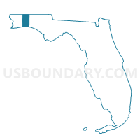
Outline
%2c+Okaloosa+County%2c+Florida_A280.png)
Summary
| Unique Area Identifier | 556917 |
| Name | 16B-Voting District (Shalimar) |
| County | Okaloosa County |
| State | Florida |
| Area (square miles) | 1.05 |
| Land Area (square miles) | 0.58 |
| Water Area (square miles) | 0.46 |
| % of Land Area | 55.90 |
| % of Water Area | 44.10 |
| Latitude of the Internal Point | 30.43854680 |
| Longtitude of the Internal Point | -86.58277630 |
Maps
 in Okaloosa County.png)

Graphs
Select a template below for downloading or customizing gragh for 16B-Voting District (Shalimar), Okaloosa County, Florida
%2c+Okaloosa+County%2c+Florida_T0.png)
%2c+Okaloosa+County%2c+Florida_T1.png)
%2c+Okaloosa+County%2c+Florida_T2.png)
%2c+Okaloosa+County%2c+Florida_T3.png)
%2c+Okaloosa+County%2c+Florida_T4.png)
%2c+Okaloosa+County%2c+Florida_T5.png)
%2c+Okaloosa+County%2c+Florida_T6.png)
%2c+Okaloosa+County%2c+Florida_T7.png)
%2c+Okaloosa+County%2c+Florida.png)
Neighbors
Neighoring Voting District (by Name) Neighboring Voting District on the Map
- 16A-Voting District (North Shalimar), Okaloosa County, FL
- 16C-Voting District (Central Shalimar), Okaloosa County, FL
- 18A-Voting District (Garnier Bayou), Okaloosa County, FL
- 19A-Voting District (East FWB), Okaloosa County, FL
- 23A-Voting District (Eglin AFB), Okaloosa County, FL
- 28A-Voting District (Garniers), Okaloosa County, FL
- 31A-Voting District (Poquito Bayou), Okaloosa County, FL
- 32A-Voting District (Ferry Park), Okaloosa County, FL
- 37A-Voting District (Lake Loraine), Okaloosa County, FL
Top 10 Neighboring County Subdivision (by Population) Neighboring County Subdivision on the Map
Top 10 Neighboring Place (by Population) Neighboring Place on the Map
- Fort Walton Beach city, FL (19,507)
- Lake Lorraine CDP, FL (7,010)
- Ocean City CDP, FL (5,550)
- Eglin AFB CDP, FL (2,274)
- Shalimar town, FL (717)
Top 10 Neighboring Unified School District (by Population) Neighboring Unified School District on the Map
Top 10 Neighboring State Legislative District Lower Chamber (by Population) Neighboring State Legislative District Lower Chamber on the Map
Top 10 Neighboring State Legislative District Upper Chamber (by Population) Neighboring State Legislative District Upper Chamber on the Map
Top 10 Neighboring 111th Congressional District (by Population) Neighboring 111th Congressional District on the Map
Top 10 Neighboring Census Tract (by Population) Neighboring Census Tract on the Map
- Census Tract 208, Okaloosa County, FL (5,114)
- Census Tract 215.02, Okaloosa County, FL (3,917)
- Census Tract 215.01, Okaloosa County, FL (3,890)
- Census Tract 224, Okaloosa County, FL (3,764)
- Census Tract 223, Okaloosa County, FL (2,341)
- Census Tract 216, Okaloosa County, FL (1,893)
- Census Tract 9902, Okaloosa County, FL (0)